This pub is located at the junction of Woodthorpe Drive and Woodborough Road, in Mapperley’s town centre, at the top of a long, steep climb out of the city. Woodthorpe Drive descends from the west side of Mapperley, past Woodthorpe Grange, a grade II listed house built in 1874. Acquired by Nottingham City Council in 1921, the estate was converted into Woodthorpe Park – ‘rich in mature trees, ornamental gardens and enjoyable walks’.
Photographs and text about The Woodthorpe Top.
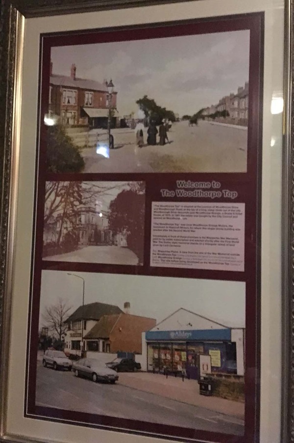
The text reads: The Woodthorpe Top is situated at the junction of Woodthorpe Drive and Woodborough Drive descends past Woodthorne Grange, a grade II listed house, of 1874. In 1921 the estate was bought by the City Council and opened as Woodthorpe Park.
The Woodthorpe Top was once Woodthorpe Grange Motors, the successor to Hopcroft Motors, for whom this single-storey building was erected after the Secondary World War.
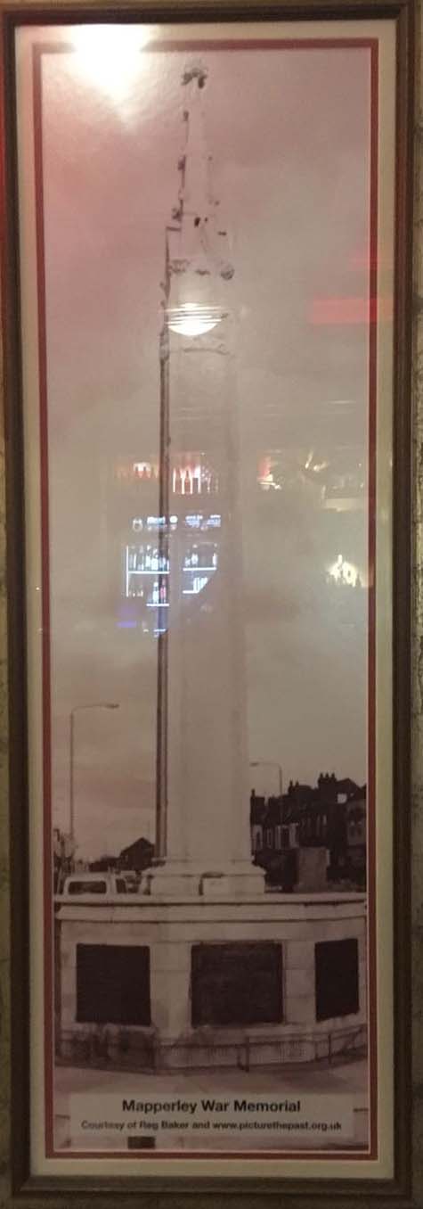
Immediately in front of these premises is the Mapperley War Memorial, paid for by public subscription and erected shortly after the First World War. The Gothic style memorial stands on a triangular island of land given by Lord Carnavon.
Top: Mapperley Plains. A view from the site of the War Memorial outside the Woodthorpe Top
Left: Woodthorpe Grange
Below: This site before being developed as The Woodthorpe Top.
A print and text about Richard Parkes Bonington.
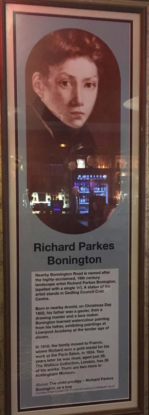
The text reads: Nearby Bonnington Road is named after the highly-acclaimed, 19th century landscape artist Richard Parkes Bonington, (spelled with a single ‘n’). A statue of the artist standing in Gedling Council Civic Centre.
Born in nearby Arnold, on Christmas Day 1802, his father was a gaoler, then a drawing master and a lace-maker. Bonington learned watercolour painting from his father, exhibiting paintings at Liverpool Academy at the tender age of eleven.
In 1818, the family moved to France, where Richard won a gold medal for his work at the Paris Salon, in 1824. Two years later he was dead, aged just 26. The Wallace Collection, London, has 35 of his works. There are two more in Nottingham Museum.
Above: The child prodigy – Richard Parkes Bonington as a boy.
Photographs and text about DH Lawrence.

The text reads: Breck Hill Road, almost alongside these premises, once led to the farmhouse that was the family home of Jesse Chambers. Jesse was the “first love” of DH Lawrence’s novel Sons and Lovers, published in 1913.
Top Left: The Lawrence family, with DH standing between his parents
Right: DH Lawrence in 1908
Top centre: Jesse Chambers, c1913
Top right: Lawrence’s birthplace, Victoria Street, Eastwood
Far right: Haggs farm, home of the Chambers family.
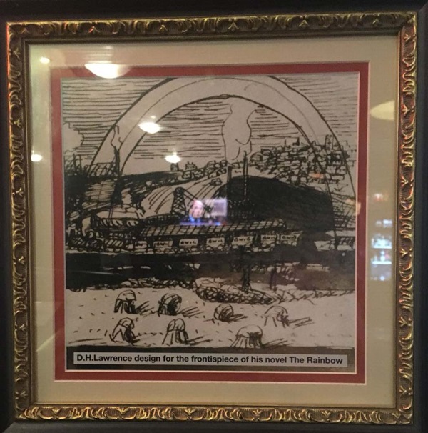
DH Lawrence design for the frontispiece of his novel The Rainbow.
Prints and text about timber and coal.
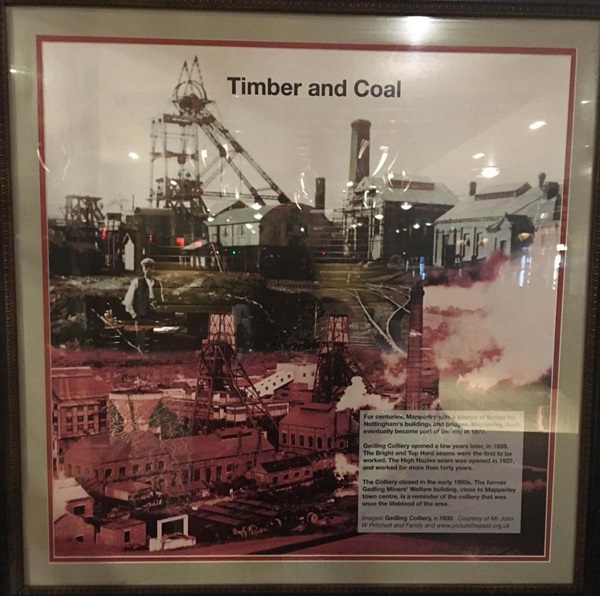
The text reads: For centuries, Mapperley was a source for Nottingham’s buildings and bridges. Mapperley itself, eventually became part of the city in 1877.
Gedling Colliery opened a few years later, in 1889. The Bright and Top Hard seams were the first to be worked. The High Hazles seam was opened in 1927, and worked for more than forty years.
The colliery closed in the early 1990s. The former Gedling Miners’ Welfare building, close to Mapperley town centre, is a reminder of the colliery that was once the lifeblood of the area.
Image: Gedling Colliery, c1930.
A photograph and text about Corner’s Field.
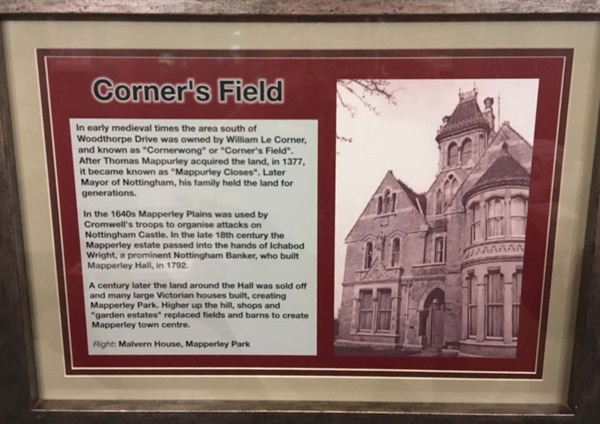
The text reads: In early medieval times the area south of Woodthorpe Drive was owned by William Le Corner, and known as Cornerwong or Corner’s Field. After Thomas Mappurley acquired the land, in 1377, it became known as Mappurley Closes. Later mayor of Nottingham, his family held the land for generations.
In the 1640s Mapperley Plains was used by Cromwell’s troops to organise attacks on Nottingham Castle. In the late 18th Century the Mapperley estate passed into the hands of Ichbod Wright, a prominent Nottingham Banker, who built Mapperley Hall, in 1792.
A century later the land around the hall was sold off and many large Victorian houses built, creating Mapperley Park. Higher up the hill, shops and garden estates replaced fields and barns to create Mapperley town centre.
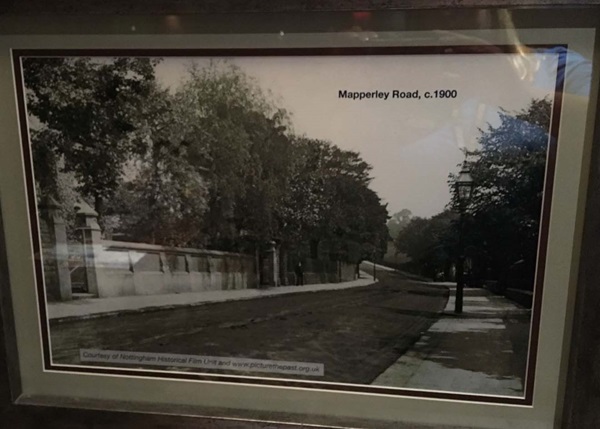
A photograph of Mapperley Road, c1900.
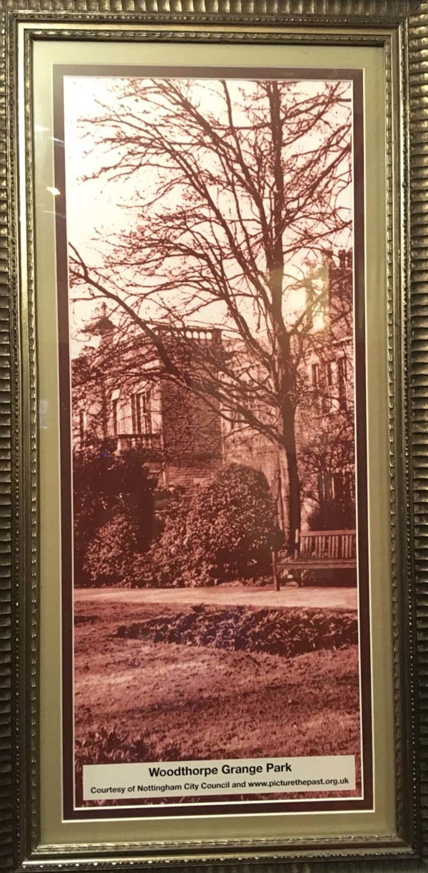
A photograph of Woodthorpe Grange Park.
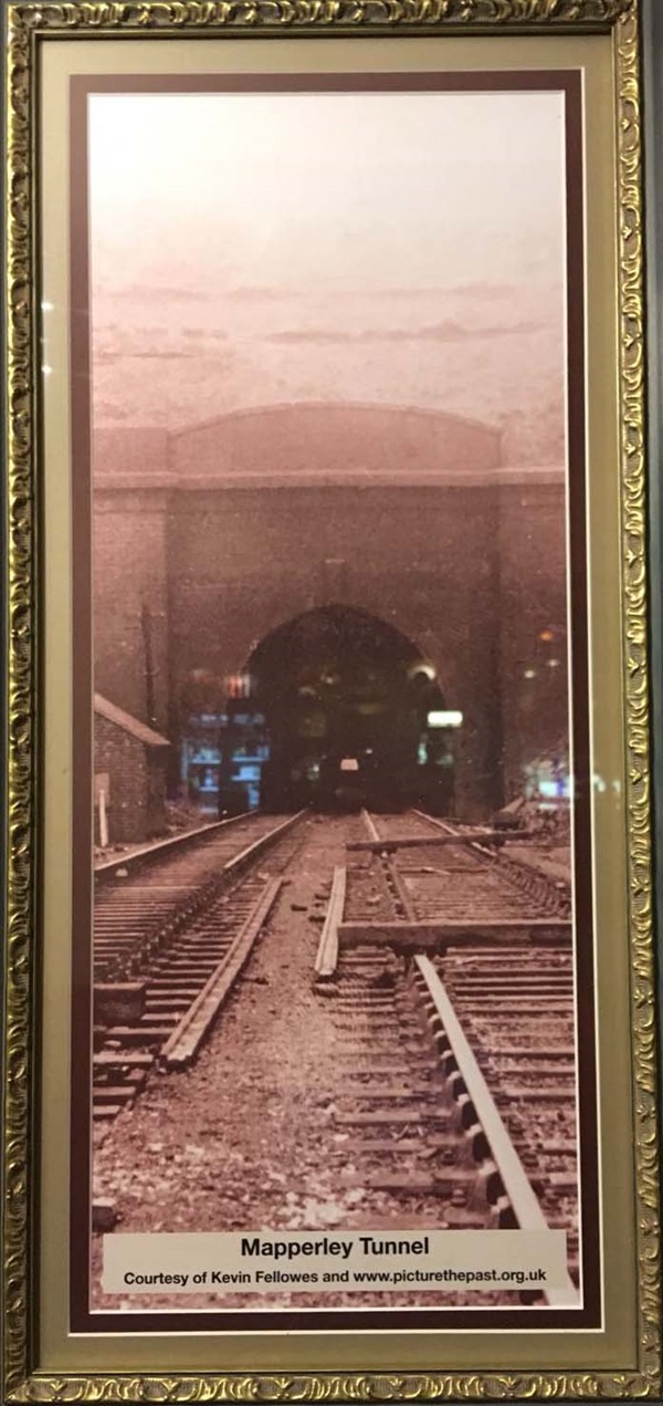
A photograph of Mapperley Tunnel.
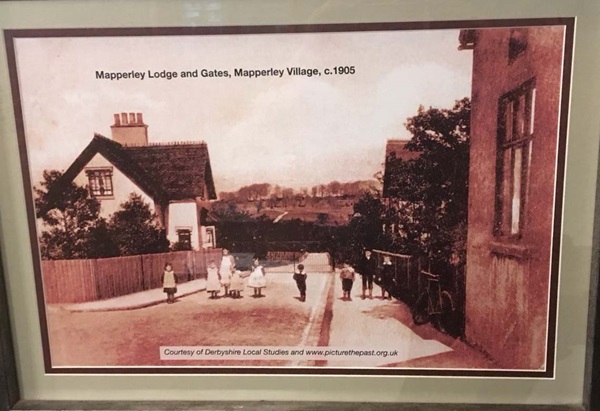
A photograph of Mapperley Lodge and Gates, Mapperley Village, c1905.
A photograph of Middlebeck Farm, Mapperley Plains, c1910.

A photograph of Mapperley War Memorial.
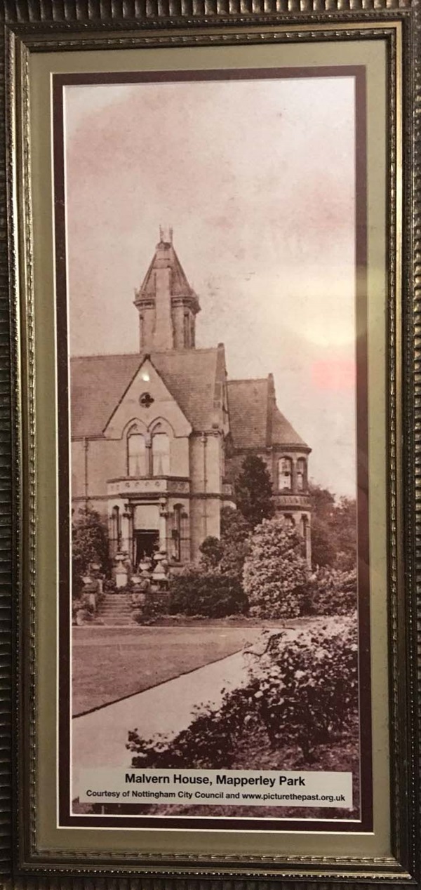
A photograph of Malvern House, Mapperley Park.
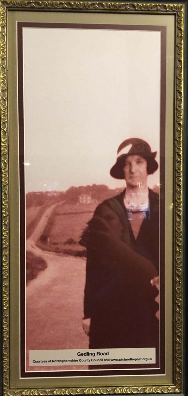
A photograph of Gedling Road.
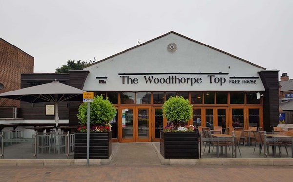
External photograph of the building – main entrance.
If you have information on the history of this pub, then we’d like you to share it with us. Please e-mail all information to: pubhistories@jdwetherspoon.co.uk